Vegetation

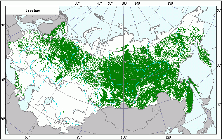
Boundaries of Forests .

Download GIS-layers

Compilation date:

15.05.2005.

Scale:

10 km/pix

Map's precision:

The layer contains information about forest scarcity on patches the earth's surface with the area of 10 x 10 km. It is compiled on the basis of a 1:2,500,000 map published in 1990.

Projection:

"Albers Equal Area for the USSR ":
ref. system : Albers Equal Area Conic for Russia
projection : Albers Equal Area Conic
datum : Pulkovo 1942 (S42)
delta WGS84 : 28 -130 -95
ellipsoid : Krasovsky
major s-ax : 6378245.000
minor s-ax : 6356863.019
origin long : 100
origin lat : 0
origin X : 0
origin Y : 0
scale fac : na
units : m
parameters : 2
stand ln 1 : 44
stand ln 2 : 68

Main contents:

A bitmapped map containing information about forest scarcity.

Classifier precision:

The raster layer includes three gradations: 1 - territories with forests, 0 - territories with no forest, -100 - territories outside the map.

Map compilation procedure:

The map has been compiled on the basis of the map of forests compiled by the Department of Forest Cartography of All-Union State Project and Survey Institute Soyuzghiproleskhoz (1990). All its forest varieties have been combined into a single forest layer.

Data sources:

Garsia, M.G., ed. 1990. Forests of the USSR (a 1:2,500,000 map). Department of Forest Cartography of All-Union State Project and Survey Institute Soyuzghiproleskhoz. GUGK, Moscow.
 

Web design —
Kelnik studios