
Crops
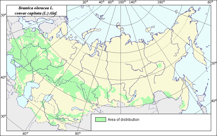
The distribution area of Red Cabbage (Brassica oleracea L. convar capitata (L.) Alef. var. capitata L. f. rubra (L.) Thell. [var. rubra (L.) Thell])
 Object description Download GIS-layers
Author:
N.V. Terekhina.Date of creation:
15.12.2004.Scale:
1:20,000,000.Accuracy of map:
Map was created using the Arable Land Map. Map is on the Oblast level and set to the scale of 1:20,000,000.The projection:
"Alber's Equal Area Conic for Russia", 9, 1001, 7, 100, 0, 44, 68, 0, 0.Basic contents:
The vector map of the distribution area consists of a layer and polygons.Accuracy of the qualifier:
Maps were created using generalized information about species distribution from published sources.Mapping procedure:
The distribution area map was created using published data (State list, 1994, 2004; Agricultural, 1960; Vehov, 1978 and others) and for the Arable Land Map of the USSR (Koroljeva et al, 2003). Red cabbage is cultivated everywhere on agriculture lands, even in the central regions of Yakutia.Sources of data:
Koroljeva, I.E., Vilchevskaya, E.V., Ruhovich, D.I. 2003. The Computer map of the arable land produced by specialists from the Soil Laboratory of the Dokuchaev Soil Institute (Moscow) (based on the Map of Land Use published in 1989 by the Problem Laboratory of Complex Cartography (the Faculty of Geography, MSU)). Moscow.Recommendations by cultivation of vegetables in open ground of Yakutia. 1975. Yakutsk.
Rusanov, B.G. 2000. Cabbage. St. Petersburg.
Starikova, D.A. 1989. Cabbage. Novosibirsk.
State List of Selection Achievements, Admitted to Use. 1994. Moscow.
State List of Selection Achievements, Admitted to Use. 2004. Moscow.
Tulupnikov, A.I., ed. 1960. Agricultural Atlas of USSR. Moscow.
Vehov V.N., Gubanov I.A., Lebedeva G.F. 1978. Cultural plants of the USSR. Moscow.
Right and copyright:
Copyright on the map, description and photo belong to the author.© Terekhina N.V.