
Crops
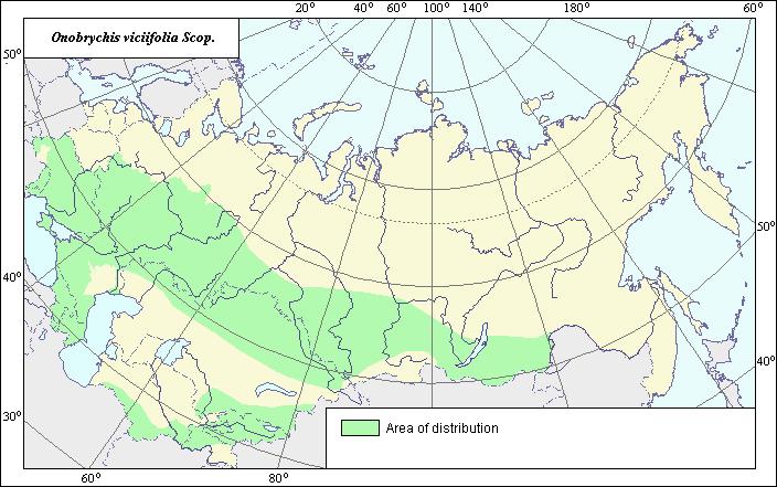
The cultivated area of sainfoin (Onobrychis viciifolia Scop.).
 Object description Download GIS-layers
Authors:
The experts - N.I. Dzyubenko, E.A. Dzyubenko.The GIS-Expert - Dzyubenko A. N.
Date of creation:
18.12.2003Scale:
1:20 000 000.Accuracy of map:
The map was created using maps that had the following scale 1:25 000 000-1:40 000 000.The projection:
"Alber's Equal Area Conic for Russia", 9, 1001, 7, 100, 0, 44, 68, 0, 0Basic contents:
Map is a vector file consisting of polygons. Polygons represent area of possible distribution of the species.Accuracy of classifier:
Polygons are based on literature sources, herbarium samples, political boundaries and field surveys by the authors.Method of map production:
Historic agricultural statistics were reviewed at the level of agricultural region. The Former Soviet Union had 16 regions. The boundaries from the 1:4000000 map of arable lands were used to further refine crop distribution (Koroljeva et al., 2003). The final map was constructed by generalization of regions. maps, arable-lands. map (dark blue polygon), map of lands permitted for cultivation without non-arable-lands (light blue polygon). Only those lands where Onobrychis viciifolia took place in crop rotation were taken into account.Reference citations:
Catalog of agricultural crops. cultivars permitted in Byelorussia. 1985. -Minsk: Uradjai, 176 pp. (In Russian)Catalog of state permitted cultivars of agricultural crops. 1969. -Moscow: Kolos, 489 pp. (In Russian)
Catalog of state permitted cultivars of agricultural crops. 1971. -Moscow: Kolos, 488 pp. (In Russian)
Catalog of state permitted cultivars of agricultural crops. 1974. -Moscow: Kolos, 480 pp. (In Russian)
Catalog of state permitted cultivars of agricultural crops. 1985. -Moscow: Kolos, V. 3: 489. (In Russian)
Koroljeva IE, Vilchevskaya EV, Ruhovich DI. 2003. Digital Arable Land Map. Laboratory of Soil Information of the Dokuchaev Soil Institute, Moscow, Russia [Based on: Yanvareva LF. (ed.), Martynjuk KN., Kisileva NM. 1989. Map of Land Use, Faculty of Geography, Moscow State University, Moscow, Russia.].
State register of breeding achievements permitted for utilization. Plant cultivars. 2003. -Moscow: 236 pp. (In Russian)
The register of plant cultivars in Ukraine. 1996. -Kiev: Urojai, 259 pp. (In Russian)
Rights and copyrights:
Copyright on the map and descriptions belong to its authors;Copyright on the photos belong to Dzyubenko, N.I.