
Diseases
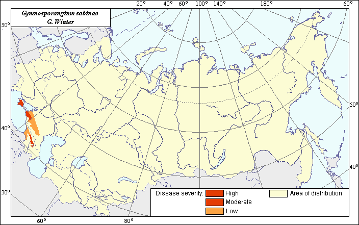
Distribution and severity zones of Pear Rust (Gymnosporangium sabinae G. Winter)
 Object description Download GIS-layers
Authors:
Specialist-biologist - I.V. Bilder, GIS-specialist - M.I. Saulich.Date of creation:
20.03.2005Scale:
1:20 000 000Accuracy of map:
Map was created based on map of natural scale 1: 33 000 000.Projection:
"Alber's Equal Area Conic for the USSR", 9, 1001, 7, 100, 0, 44, 68, 0, 0Basic contents:
Vector map. Area of species distribution and zones of disease severity are shown by polygons.Accuracy of classifier:
The disease distribution was determined according to the regions where Rust of pear is registered on fruit crops according to published scientific materials. Three zones of disease severity were allocated within the limits of the area. The disease occurs at least 1 time in 2 years or almost annually in the zone of high severity (50-100% trees are affected), 1 time in 3 years in the zone of moderate development (31-50% trees are affected), and 1 time in 5 years in the zone of low severity (15-30% trees are affected).Method of map production:
Scientists were given maps with boundaries of Oblasts and arable lands. After reviewing historic literature, species distribution was hand drawn on maps. If data were on the Oblast-level, distribution is on the Oblast level. In some cases, Oblast.s are further refined by boundaries of the Arable Land Map (Koroljeva et al., 2003). Hand drawn maps were scanned, georeferenced and vectorized. The high severity zone includes the Black Sea part of Krasnodar Territory and Ukraine (Crimea). The moderate severity zone includes East Georgia. The low severity zone includes the central and southern parts of the Krasnodar and Stavropol Territories, republics of Adygea and Karachay-Cherkessia, Western Georgia according to the following sources: Mitrophanova (1968, 1970), Petrushova & Mitrophanova (1972), Tsvedadze (1987), Smolyakova (2000). Corrections to the disease distribution and severity zones configuration was determined according to the map of fruit-trees distribution from Tochenov et al. (1984). Borders of the disease distribution and severity zones within the limits of Karachay-Cherkessia and Adygea are slightly shifted southward in relation to the southern border of fruit-tree distribution according to the data of above mentioned authors.Reference citations:
Koroljeva IE, Vilchevskaya EV, Ruhovich DI. 2003. Digital Arable Land Map. Laboratory of Soil Information of the Dokuchaev Soil Institute, Moscow, Russia [Based on: Yanvareva LF. (ed.), Martynjuk KN., Kisileva NM. 1989. Map of Land Use, Faculty of Geography, Moscow State University, Moscow, Russia.].Mitrofanova O.V. 1968. The Rust of pear in Crimea (species composition of pathogens, morphology, biology, the causes of epiphytotic development, protective measures). Leningrad: LSKHI. 21 p. (In Russian)
Mitrofanova O.V. 1970. The rust of pear and its control. Crimea: Simferopol. 46 p. (In Russian)
Petrushova N.I., Mitrofanova O.V. 1972. Biological features of the Pear Rust pathogen Gymnosporangium Dobrozrakovae O.V. Mitrophanova in Crimea. Pests and diseases of fruit and ornamental plants. V. 61. Yalta: State Nikitin Garden. 123-132 p. (In Russian)
Smolyakova V.M. 2000. Diseases of orchard in the South of Russia. Krasnodar: Vest.. 192 p. (In Russian)
Tsvedadze L.P. 1987. Biological features of the Pear Rust development and its control in conditions of Georgia. Yerevan: Goskomisdat Georgian SSR. 24 p. (In Russian)