
Relatives
The area of a edge flowerd crested wheatgrass (Agropyron dasyanthum )
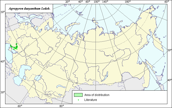 Object description Download GIS-layers
Author:
The expert-botanist and the GIS-expert - L.L. MalyshevDate of creation:
07.07.2003Scale:
1:20.000.000.Accuracy of a map:
It is created on materials of maps of scale 1:12.000.000-1:40.000.000.The projection:
"Alber's Equal Area Conic for Russia", 9, 1001, 7, 100, 0, 44, 68, 0, 0Basic contents:
The vector map consists of 1 base layer and 2 thematic layers. The area of a species is submitted by range and points.Accuracy of the qualifier:
Points submit the information on sites of a species given under references, range - the generalized information on distribution of a species under references.The technique of drawing up of a map:
The basis of a map of the area is are the published map from "Grasses of Ukraine" (1977); map of Buchteeva et al. (1990) for Research Bulletin of VIR.Sources of the data:
Grasses of the Ukraine. - Kiev: "Naukova Dumka", 1977. - 518 p.Buchteeva A.V., Malyshev L.L., Konarev A.V. Wild wheat grass populations in the eastern Europian steppe province // Bull.VIR. - 1990. - N 198. - P.54-59.
Right and copyright:
Copyright on this map and description belongs to its author.Copyright on the photos belong to Dzyubenko E.