Relatives
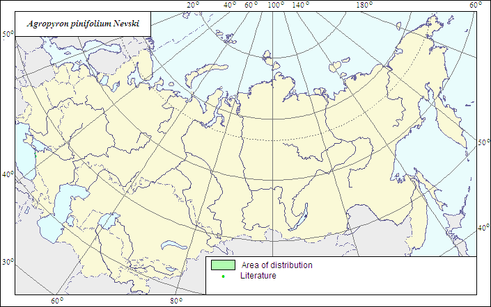
Range of distribution of Rigid-leaved Wheatgrass (Agropyron pinifolium) .
 Object description Download GIS-layers
|
|

RelativesRange of distribution of Rigid-leaved Wheatgrass (Agropyron pinifolium) . Object description Download GIS-layers
Author:The expert-botanist and the GIS expert - L.L.Malyshev.Date of creation:25.06.07Scale:1:20 000 000.Accuracy of the map:The map is based on data of 1:12 000 000-1:40 000 000 scale maps.Projection:"Albers Equal-Area Conic Projection for USSR", 9, 1001, 7, 100, 0, 44, 68, 0, 0Basic contents:The map is a vector file consisting of 1 basic and 2 subject layers. The species range is represented by a polygon and dots.Accuracy of the qualifier:The dots represent information on the species localities according to published sources (2), the polygon - generalized information on the species distribution.Method of the map contruction:The range map is based on published maps (Grossheim, 1939). The species is a local endemic, with a range limited by calcareous rocks of the Black Sea coast between Anapa and Gelendzhik towns. N.N.Tzvelev (1976) includes in A.pinifolium also A.karadaghense Kotov, which is distinct by dense villous pubescence of spikelets, but Yu.N.Prokudin treats the latter as one of the forms of A.ponticum widespread there and variable in its traits.References:Grossheim AA. 1939. Flora of Caucasus. 2nd ed. V.1. 402 p. (In Russian).Rights and copyrights:The copyrights of the map and descriptions are held by their author. |
|
|
|
|
Web design — |