Relatives
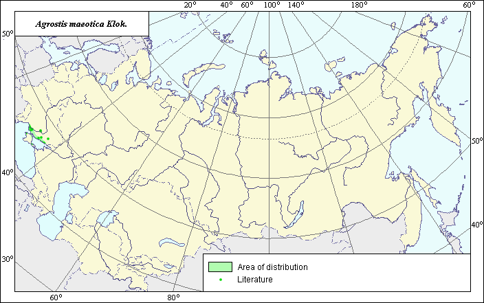
Area of Azov bentgrass (Agrostis maeotica) .
 Object description Download GIS-layers
|
|

RelativesArea of Azov bentgrass (Agrostis maeotica) . Object description Download GIS-layers
Authors:Scientist and GIS-specialist - L.L.Malyshev.Date of creation:15.03.2004.Scale:1:20,000,000.Accuracy of map:Created based on materials of maps of scale 1:12,000,000.Projection:"Alber.s Equal Area Conic for Russia. 9, 1001, 7, 100, 0, 44, 68, 0, 0.Basic contents:Vector map. Area of species distribution is shown by polygons, actual location occurrence in shown by points.Accuracy of classifier:Point data were obtained from literature sources and herbarium specimens. Polygons are based on literature sources, herbarium samples, and field surveys by the authors.Method of map production:Published literature was reviewed, including Atlases, monographs and papers. Occurrence data were obtained from herbarium specimens, floras, monographs and papers (Shelyak-Sosonko, 1977). The area of the species was determined for the lower sites on the coast of the Azov and the Black seas occupied by shelly-sandy salinas. Data were then compiled through scanning and geo-referencing to develop a composite vector map. The biologist and GIS specialist drew a new plant distribution area based on compiled data.Reference citations:Shelyak-Sosonko, Y.P., ed. 1977. Grasses of Ukraine. Kiev: Naukova Dumka. 518 pp. (in Russian).Rights and copyrights:All rights on map and descriptions belong to its author. |
|
|
|
|
Web design — |