
Relatives
Range of distribution of Buryat onion (Allium burjaticum Friesen).
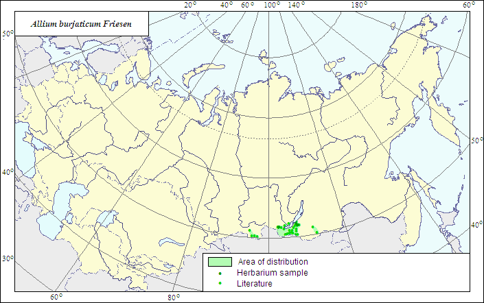 Object description Download GIS-layers
Authors:
The expert-botanist - I.G.Chukhina, the GIS expert . T.A.Sinitsyna.Date of creation:
26.10.2006Scale:
1:20 000 000.Accuracy of the map:
The map is based on data of 1:20 000 000 - 1:25 000 000 scale maps.Projection:
"Albers Equal-Area Conic Projection for USSR", 9, 1001, 7, 100, 0, 44, 68, 0, 0Basic contents:
The map is a vector file consisting of a polygon and dots. The localities of the species are represented by dots, the area of possible species distribution is represented by the polygon.Accuracy of the qualifier:
The dots represent information on the species localities according to published sources and herbarium specimens. The polygon is based on generalized information from published sources and herbarium specimens.Method of the map contruction:
The data on the species distribution were obtained from the database of the species localities coordinates included in the Information Retrieval System "Crop Wild Relatives in Russia" (STC Informregistr 0229905883, 1999), and from maps published by Friesen (1988).Borders of the range are drawn mainly after Friesen (1988), and corrected according to herbarium materials referred to in the database of the Information Retrieval System.
References:
Friesen NV. 1988. Onion plants of Siberia. Novosibirsk: Nauka. Fig.38. (In Russian).Herbarium specimens of Central Siberian Botanical Garden (NS), (Novosibirsk).
N.I.Vavilov All-Russian Institute of Plant Industry, Herbarium Department, 1999. Information Retrieval System: Crop Wild Relatives in Russia. STC Informregistr 0229905883, St.Petersburg, Russia.