
Relatives
Area of Alopecurus laguriformis Schur
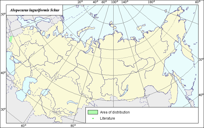 Object description Download GIS-layers
Author:
V.G.Funtova.Data of creation:
20.03.2004.Scale:
1:20 000 000.Accuracy of map:
The map was created using maps that had a scale of 1:15 000 000.Projection:
Alber's Equal Area Conic for Russia 9, 1001, 7, 100, 0, 44, 68, 0, 0.Basic contents:
Vector map. Area of species distribution is shown by polygons, actual location occurrence in shown by points.Accuracy of classifier:
Point data were obtained from literature sources and herbarium specimens. Polygons are based on literature sources, herbarium samples, and field surveys by the authors. Light-colored points are locations of species that were determined according to literature.Method of map production:
Published literature was reviewed, including Atlases, monographs and papers. Occurrence data were obtained from herbarium specimens, floras, monographs and papers. Point area includes locations of species demonstrated by Tzvelev (1976). Polygon areas were determined according to species distribution data from Tzvelev (1976). Polygon was constructed according to data by Tzvelev (1976) and with accurate definitions of the north and south borders according to the state border of Russia. The east and west borders were determined according to the border of the Carpathian Mountains as represented in the geographic atlas of Habel (1972). Data were then compiled through scanning and geo-referencing to develop a composite vector map. The biologist, together with the GIS specialist, drew a new plant distribution area based on compiled data.Reference citations:
Habel R. 1972. Geographic-Cartographic Atlas. Leipzig: VEB Hermann Haack. 412 pp. In German.Tzvelev N.N. 1976. Poaceae USSR. Leningrad: Nauka. 788 pp. In Russian.