
Relatives
Distribution area of wild barley (Hordeum spontaneum) .
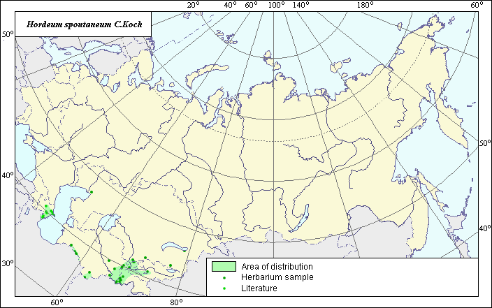 Object description Download GIS-layers
The author:
Object-expert and GIS-expert L.L. MalyshevDate of creation:
20.03.2004Scale:
1:20,000,000Accuracy of map:
Map was created using maps of scale 1:11,250,000.Projection:
"Alber.s Equal-Area Conic for the USSR ", 9, 1001, 7, 100, 0, 44, 68, 0, 0.The basic contents:
Vector map. Area of species distribution is shown by polygons, while actual location occurrence is shown by points.Accuracy of classifier:
Point data were obtained from published sources and herbarium specimens. Polygons are based on published sources, herbarium samples, and field surveys by the authors.Method of map production:
Published literature was reviewed, including atlases, monographs and papers. Occurrence data were obtained from herbarium specimens, floras, monographs and papers (V.L. Komarov Institute; Grossgeim, 1939). Within the former USSR, the species is found in foothills and the low mountain belts of Eastern Transcaucasia and Central Asia. Data were then compiled through scanning and geo-referencing to develop a composite vector map. The biologist, together with the GIS-specialist, drew a new plant distribution area based on compiled data.Reference citations:
Grossgeim A.A. 1939. Flora of the Caucasus. Vol. 2. Polypodiaceae-Gramineae. Baku: Publishing house AzFaN, 587 pages.V.L. Komarov Botanical Institute [LE], St. Petersburg, Russia.