
Relatives
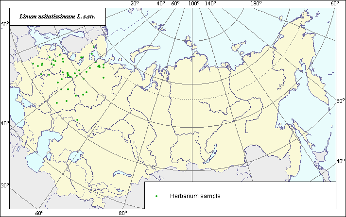
The distribution area of Common, cultivated or fiber flax (Linum usitatissimum L. s.str.)
 Object description Download GIS-layers
Authors:
Expert botanist I.G. ChuhinaGIS-expert E.I. Suzanskaja
Date of creation:
24.12.2003Scale:
1:20,000,000.Accuracy of map:
Map was created using herbarium specimens.The projection:
"Alber's Equal Area Conic for Russia", 9, 1001, 7, 100, 0, 44, 68, 0, 0.Basic contents:
Map is a vector file consisting of points. Locations of species are represented by points.Accuracy of qualifier:
Points represent locations from which herbarium specimens were taken.Method of map construction:
The data on species distribution were taken from the database of species locations, INFORMATION RETRIEVAL SYSTEM, "Wild-growing relatives of cultural plants of Russia" (STC "Informregistr" # 0229905883). This species was introduced as a cultivated plant and therefore has no a natural, initial area within the given territory. All its places of growth in a wild-growing condition are connected to secondary habitats and are the result of plants that have escaped from cultivation; therefore, the distribution area is represented only by points. Points correspond to sites at which this plant has been found in a wild-growing condition, which have been confirmed using herbarium materials from the Komarov Botanical Institute and the N.I. Vavilov All-Russian Institute of Plant Industry (VIR) and stored in a database of the information retrieval system.Sources of data:
Herbarium Specimens. Komarov Botanical Institute and N.I. Vavilov All-Russian Institute of Plant Industry (VIR) (St. Petersburg).Right and copyright:
Copyright on this map and its description belongs to its authors.Copyright on the picture belongs to I.G. Chuhina.