
Relatives
The distribution area of Medicago lupilina L.
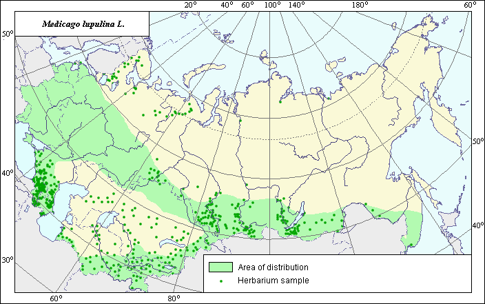 Object description Download GIS-layers
Authors:
N.I. Dzyubenko & N.V. TerekhinaDate of creation:
25.06.2003.Scale:
1:20,000,000.Accuracy of map:
Map was created using maps of natural scale 1:8,000,000-1:80,000,000.The Projection:
.Alber.s Equal Area Conic for Russia., 9, 1001, 7, 100, 0, 44, 68, 0, 0.Basic contents:
Vector map. Area of species distribution is shown by polygons, while actual location occurrence is shown by points. Points represent locations of the species outside the zone of continuous distribution.Accuracy of classifier:
Point data were obtained from published sources and herbarium specimens. Polygons are based on published sources, herbarium samples, and field surveys by the authors.Method of map production:
Published literature was reviewed, including atlases, monographs and papers. Occurrence data were obtained from herbarium specimens, floras, monographs and papers. Data were then compiled through scanning and geo-referencing to develop a composite vector map. The biologist, together with the GIS-specialist, drew a new plant distribution area based on compiled data.Reference citations:
Grossgeim, A.A. 1952. Flora of the Caucasus. Vol. 5. Moscow-Leningrad: USSR.Ivanov A.I. 1980. Lucerne. Moscow: Kolos. 350 pp.