
Relatives
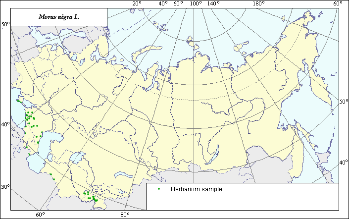
The distribution area of black mulberry (Morus nigra L.).
 Object description Download GIS-layers
Authors:
Expert botanist I.G. ChukhinaGIS-expert T.A. Sinitsyna
Date of creation:
5.06.2004.Scale:
1:20,000,000.Exactness of map:
Map was created using data from herbarium specimens.The projection:
"Alber's Equal Area Conic for Russia", 9, 1001, 7, 100, 0, 44, 68, 0, 0.Basic contents:
Map is a vector file consisting of points. Locations of species are represented by points.Accuracy of classifier:
Points represent locations from which herbarium specimens were taken.Method of map production:
The Information Retrieval System was used to obtain species location data.This species is cultivated in the former USSR and runs wild in the Crimea and, occasionally, in the Caucasus. In Middle Asia, this species often naturalizes; therefore, species distribution in this area is represented by points only. These points conform to verified locations of wild-growing plants of this species. These locations have been further confirmed using the herbarium specimens at the N.I. Vavilov Institute.
References.
N.I. Vavilov All-Russian Institute of Plant Industry [WIR], St. Petersburg, Russia.N.I. Vavilov Institute, Herbarium Department, 1992. Information retrieval system: wild-growing relatives of cultural plants of Russia. STC Informregistr 0229905883, St. Petersburg, Russia.
Right and copyright:
Copyright on this map and its description belongs to its authors.Copyright on the picture belongs S. Shuvalov.