
Relatives
Distribution area of Georgian esparcet (Onobrychis iberica) .
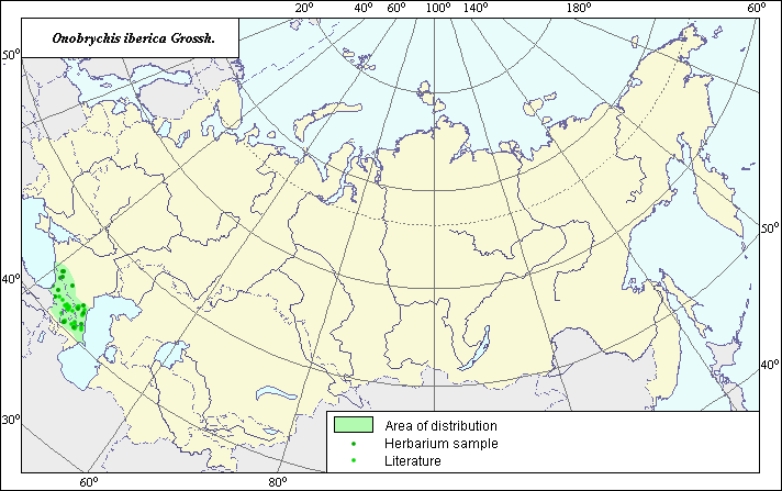 Object description Download GIS-layers
Authors:
Experts N.I. Dzyubenko & E.A. DzyubenkoGIS-expert A.N. Dzyubenko
Date of creation:
28.10.2003Scale:
1:20,000,000.Exactness of map:
The map was created using maps of scale 1:25,000,000-1:40,000,000.The projection:
"Alber's Equal Area Conic for Russia", 9, 1001, 7, 100, 0, 44, 68, 0, 0.Basic contents:
Map is a vector file consisting of polygons and points. Locations of the species are represented by points, while the areas of possible distribution of the species are represented by polygons.Exactness of classifier:
Light-colored points represent species locations referenced in published sources. Dark-colored points represent species locations reported in the BIN database (the Komorov Institute of Botany). Polygons are based on published sources, herbarium samples, political boundaries and ecological descriptions.Method of map construction:
The species distribution area was constructed using published maps and materials from the Komorov Institute of Botany. Sources consulted include the map of Onobrychis iberica distribution from Grossheim (1952) and the BIN database.Sources of data:
Database of BIN materials (the Komorov Institute of Botany).Grossheim A.A. 1952. Onobrychis genus. Flora of the Caucasus. Vol. 5. M.-L.: USSR, p. 358-373.
Rights and copyrights:
Copyright on the map and its description belongs to its authors.Copyright on the photos belongs to N.I. Dzyubenko.