
Relatives
Distribution area of Poa altaica Trin.
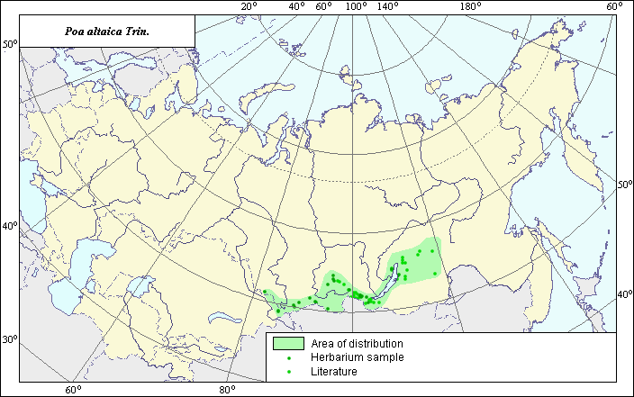 Object description Download GIS-layers
Author:
V.G. FuntovaDate of creation:
28.09.2004.Scale:
1:20,000,000.Exactness of map:
Map was created using maps of scale 1:50,000,000, 1:10,000,000, and 1:5,000,000.Projection:
.Alber's Equal Area Conic for Russia., 9, 1001, 7, 100, 0, 44, 68, 0, 0.Basic contents:
Vector map. Area of species distribution is shown by polygons, while actual location occurrence is shown by points.Accuracy of classifier:
Point data were obtained from published sources and herbarium specimens. Polygons are based on published sources, herbarium samples, and field surveys by the authors.Method of map production:
Published literature was reviewed, including atlases, monographs and papers. Occurrence data were obtained from herbarium specimens, floras, monographs and papers. Point locations of species were obtained from Malyshev & Peshkova (1979) and the V.L. Komarov Botanical Institute. Polygons were constructed using species distribution data from floristic regions from Malyshev & Peshkova (1990) and Tzvelev (1976). Final legend of map is bi-colored. Dark points represent locations of species that were determined using herbarium data. Light points represent species locations derived from published sources. Data were then compiled through scanning and geo-referencing to develop a composite vector map. The biologist, together with the GIS-specialist, drew a new plant distribution area based on compiled data.Reference citations:
Malyshev L.I., Peshkova G.A., eds. 1979. Flora of Central Siberia. Vol. 1. Novosibirsk: Nauka. 536 pp. (In Russian)Malyshev L.I., Peshkova G.A., eds. 1990. Flora of Siberia. Vol. 2. Poaceae (Graminea). Novosibirsk: Nauka. 361 pp. (In Russian)
Tzvelev N.N. 1976. Poaceae USSR. Leningrad: Nauka. 788 pp. (In Russian)
V.L. Komarov Botanical Institute [LE], St. Petersburg, Russia.
Right and copyright:
© V.G. FuntovaPhoto © K.A. Funtova