
Relatives
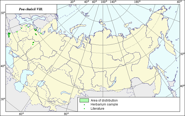
Distribution area of Poa chaixii Vill.
 Object description Download GIS-layers
Author:
V.G. FuntovaDate of creation:
14.09.2004.Scale:
1:20,000,000.Accuracy of map:
The map was created using maps of scales 1:50,000,000 and 1:100,000,000.Projection:
.Alber's Equal Area Conic for Russia., 9, 1001, 7, 100, 0, 44, 68, 0, 0.Basic contents:
Vector map. Area of species distribution is shown by polygons, while actual location occurrence is shown by points.Accuracy of classifier:
Point data were obtained from published sources and herbarium specimens. Polygons are based on published sources, herbarium samples, and field surveys by the authors.Method of map production:
Published literature was reviewed, including atlases, monographs and papers. Occurrence data were obtained from herbarium specimens, floras, monographs and papers. Point area includes species locations obtained from Hulten & Fries (1986) and the V.L. Komarov Botanical Institute. Polygon areas were constructed using species distribution data from Tzvelev (1976) and Hulten & Fries (1986). The final map legend is bi-colored. Dark points represent locations from which herbarium samples were taken. Light-colored points represent species locations cited in published literature. Several points were not included in the polygon, as the species was introduced into these regions. Data were then compiled through scanning and geo-referencing to develop a composite vector map. The biologist, together with the GIS-specialist, drew a new plant distribution area based on compiled data.Reference citations:
Hulten E., Fries M. 1986. Atlas of Northern European Vascular Plants North of the Tropic of Cancer. Vol. 1-3. Konigstein, 1172 p.Tzvelev N.N. 1976. Poaceae USSR. Leningrad: Nauka, 788 pp. (In Russian)
V.L. Komarov Botanical Institute [LE], St. Petersburg, Russia.