
Relatives
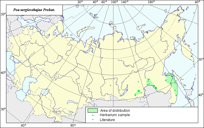
Distribution area of Sergievskaya's bluegrass (Poa sergievskajae) .
 Object description Download GIS-layers
Authors:
Object expert and GIS-expert L.L. MalyshevDate of creation:
29.03.2005.Scale:
1:20,000,000.Accuracy of map:
Map was created using maps of scale 1:2,000,000-1:11,250,000.Projection:
"Alber.s Equal Area Conic for Russia", 9, 1001, 7, 100, 0, 44, 68, 0, 0.Basic contents:
Vector map consists of 1 base and 3 thematic layers. The species distribution area is shown by polygons and points.Accuracy of qualifier:
Points represent locations from which L.E. herbarium samples were taken and species locations referenced in published literature. The polygon was created using general species distribution data from published sources.Mapping procedure:
The species distribution area was mapped using data from the BIN herbarium and published maps in Malyshev & Peshkova (1979) and Kharkevich (1985). The distribution area consists of three independent sites: the upper Shilka River region, the Zeja-Amur plateau and north of Sikhote Alin.Sources of data:
Kharkevich S.S., ed. 1985. Vascular Plants of the Soviet Far East. Vol.1. Leningrad: Nauka, 398 pages.Malyshev L.I., Peshkova G.A., eds. 1979. Flora of Central Siberia. Vol. 1. Onocleaceae-Saxifragaceae. Novosibirsk: Nauka, 431 pages.
Rights and copyrights:
All rights to the map and its description belongs to its author.Copyright on the photos belongs to E. Dzyubenko.