
Relatives
The distribution area of Fountain currant (Ribes fontaneum Boczkarn.)
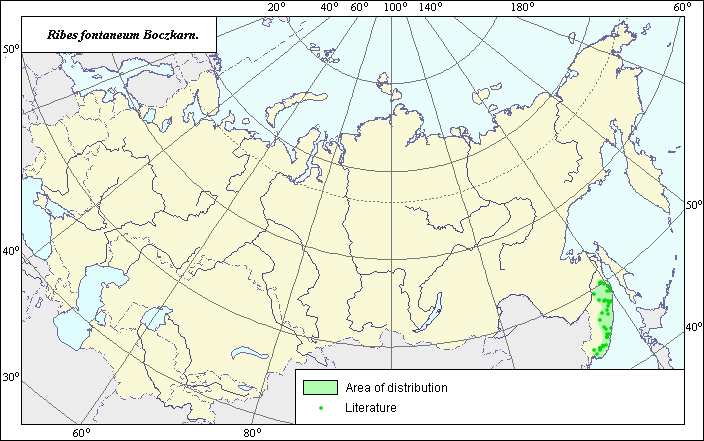 Object description Download GIS-layers
Authors:
Expert botanist T.N. SmekalovaGIS-expert G.V. Talovina
Date of creation:
06.11.2003Scale:
1:20,000,000.Accuracy of map:
Map was created using herbarium materials and a map of scale 1:25,000,000.The projection:
"Alber's Equal Area Conic for Russia", 9, 1001, 7, 100, 0, 44, 68, 0, 0.Basic contents:
Vector map. The species distribution area is shown by a polygon and points.Accuracy of qualifier:
Points represent species locations referenced in published literature and from which herbarium specimens were taken. The polygon was created using generalized information on species distribution from published references and herbariums.Mapping procedure:
The species distribution area was mapped following an analysis of published maps and other sources. The map is largely based on map of Ribes fontaneum distribution in Harkevich (1988) and was further specified using Bochkarnikova's data (1973). The map was then scanned. Registration and vectorization of the raster image were performed using standard GIS technologies.Sources of data:
Bochkarnikova, N.M. 1973. Black currant in the Far East. Vladivostok, Far East Publishing House, pp. 60-78.Harkevich S.S., ed. 1988. Vascular plants of the Soviet Far East. Vol. 3. Leningrad, Nauka, p. 123. (in Russian).
Right and copyright:
Copyright on this map and its description belongs to its authors.Copyright on the picture belongs to Sabitov Andrew.