
Relatives
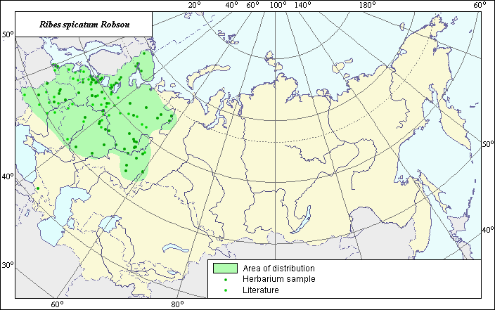
The distribution area of Spiked currant (Ribes spicatum) .
 Object description Download GIS-layers
Authors:
Expert-botanist T.N. SmekalovaGIS-expert G.V. Talovina
Date of creation:
15.10.2003Scale:
1:20,000,000.Accuracy of map:
Map was created using herbarium materials and maps of scale 1:30,000,000.The projection:
"Alber's Equal Area Conic for Russia", 9, 1001, 7, 100, 0, 44, 68, 0, 0.Basic contents:
Vector map. The species distribution area is shown by polygons and points.Accuracy of qualifier:
Points represent species locations referenced in published literature and from which herbarium specimens were taken. The polygon was created using generalized information on species distribution from published references and herbariums.Mapping procedure:
The map was created using locations from which herbarium specimens were taken and maps published in Pojarkova (1936). The map was further specified using Ramenskaya (1983).Sources of data:
Materials from herbariums at the Vavilov Institute, Komarov Botanical Institute (BIN).Poyarkova, A.I. 1936. Critical review of wild currant and gooseberry species in the Soviet Union. Flora and taxonomy of higher plants. Works of the Botanical Institute, USSR Academy of Sciences, series 1, issue 2, pp. 153-216. (in Russian).
Ramenskaya M.L. 1983. Vasular plants of Murmansky district and Karelia.
Moscow - Leningrad: Nauka, p. 186.