
Relatives
Area of Trifolium apertum (open clover ).
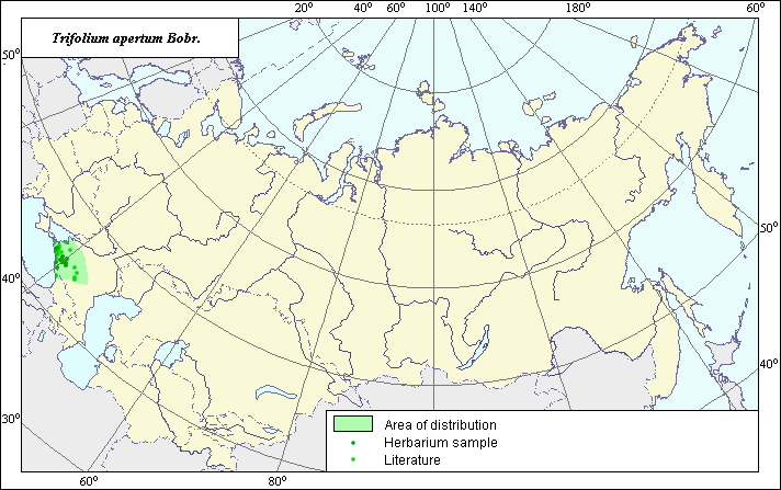 Object description Download GIS-layers
Authors:
The experts - Dzyubenko N. I., E. A. Dzyubenko.The GIS-Expert - Dzyubenko A. N.
Date of creation:
28.10.2003.Scale:
1:20.000.000.Exactness of a map:
The map was created using maps that had the following scale 1:25.000.000-1:40.000.000.The projection:
"Alber's Equal Area Conic for Russia", 9, 1001, 7, 100, 0, 44, 68, 0, 0.Basic contents:
Map is a vector file consisting of polygons and points. Points represent locations of species, area of possible distribution of species are represented by polygons.Accuracy of classifier:
Light-colored points are locations referenced in literature sources. Dark-colored points are locations of species obtained from the herbarium and seed collection of the N.I. Vavilov All-Russian Research Institute of Plant Industry. Polygons are based on literature sources, herbarium samples, political boundaries and ecological description.Method of map production:
Published literature was reviewed, including Atlases, monographs and papers. Occurrence data were obtained from herbarium specimens, floras, monographs and papers (Grossheim, 1952); (VIR database). Data were then compiled through scanning and geo-referencing to develop a composite vector map. The biologist together with the GIS specialist, drew a new plant distribution area based on compiled data.Reference citations:
Grossheim A.A. 1952. Genus Trifolium. Flora of the Caucasus. M.-L.: AN USSR. V.5: 194-221. (In Russian)Rights and copyrights:
Copyright on the map and descriptions belong to its authors;Copyright on the photos belong to Dzyubenko N.I.