
Relatives
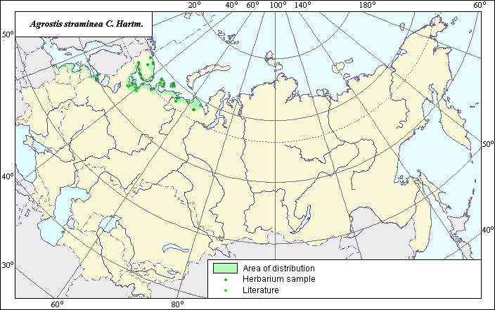
Areal of Agrostis straminea C. Hartm.
 Object description Download GIS-layers
Author:
V.G.FuntovaData of creation:
31.05.2004.Scale:
1:20 000 000.Exactness of the map:
The map created with using maps, that had scale 1:50 000 000, 1:10 000 000Projection:
Alber's Equal Area Conic for Russia 9, 1001, 7, 100, 0, 44, 68, 0, 0Basic content:
Map is vectorial. Locations of species present by points, area of possible distribution of species present by polygon.Exactness of classifier:
Points of different colors are locations of species that were fixed by literature and that were fixed by herbarium.Method of map constraction:
Point areal includes locations of species from edition: Flora of north-eastern European part USSR (Tolmachev, 1974), locations of specimens from Herbarium of V.L. Komarov Botanic Institute. Polygon areals were made using data about distribution of species in floristic regions from: Poaceae USSR (Tzvelev, 1976). Final legend of map is bicolor. Dark points - locations of species that were fixed by herbarium. Light points are locations of species that were fixed by literature. Polygon disjunctive areal is result integration of point data of species locations by data of European part USSR (Tolmachev, 1974), Herbarium of V.L. Komarov Botanic Institute and data about distribution of species in floristic districts by data Poaceae USSR (Tzvelev, 1976) into account ecology data from .Descriptions. and correct sea border of polygon by coast line.Source of data:
Tolmachev, A.I. (ed.). Flora of north-eastern European part USSR. 1974. vol.1. Leningrad: Nauka, 75 pp. (in Russian)Tzvelev, N.N. 1976. Poaceae USSR. L.: Nauka, 788 pp. (in Russian).
Herbaria V.L.Komarov Botanical Institute